Event Name: University of Maryland AOSC Senior Research Symposium 2024
Event time and place: 05/02/2024 at 3:30PM in the Atlantic Building on UMCP main campus
-
--- Poster One: Feasibility of Extratropical Cyclone Detection to Use Synthetic Aperture Radar ---
By Reuven Ben-Zeev
-
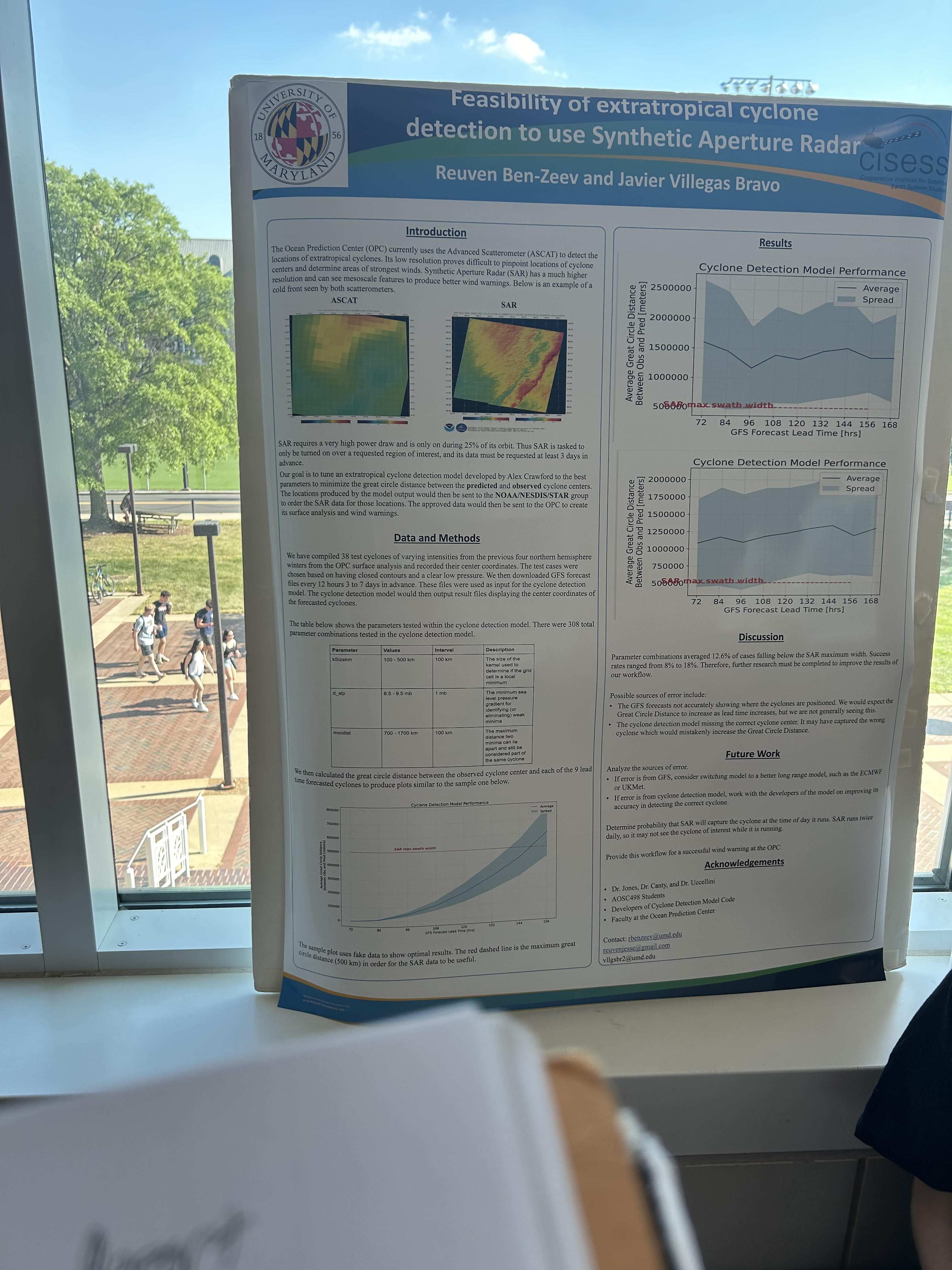
--- The Ocean Prediction Center (OPC) currently uses the Advanced Scatterometer to detect the locations of extratropical cyclones. Its low resolution makes it difficult to predict and analyze storm features.
--- Synthetic Aperture Radar (SAR) has a higher resolution output, which makes analysis easier and improves GFS Cyclone Detection Model performance.
--- The National Hurricane Center (NHC) already uses SAR, but they feed it manually gathered data. The OPC lacks sufficient access to manual input, which would make using SAR unfeasible. As a result, they must use satellites and other methods to make their predictions.
--- The goal of this project was to eventually have auto-generated input (i.e. the Cyclone Detection Model) for the OPC to feed the SAR product. However, the CDM rarely provides input that falls within the spectrum width of SAR.
--- Going forward, Reuven plans to find what parameters bring the accuracy of the CDM below SAR spectrum width so it can be analyzed.
-
The poster was overall effective. It went into great detail about data sets, project purpose, future work, and issues encountered. The images that were included were informative and interesting. It is worth noting that the poster was very text-dense, making it difficult to read and dull. However, the presenter made up for it by being energetic and describing everything in a way that is easily understandable.
-
--- Poster Two: The Role of Pacific Decadal Oscillation (PDO) in Western American Snowpack Patterns ---
By Ethan Heidtman
-
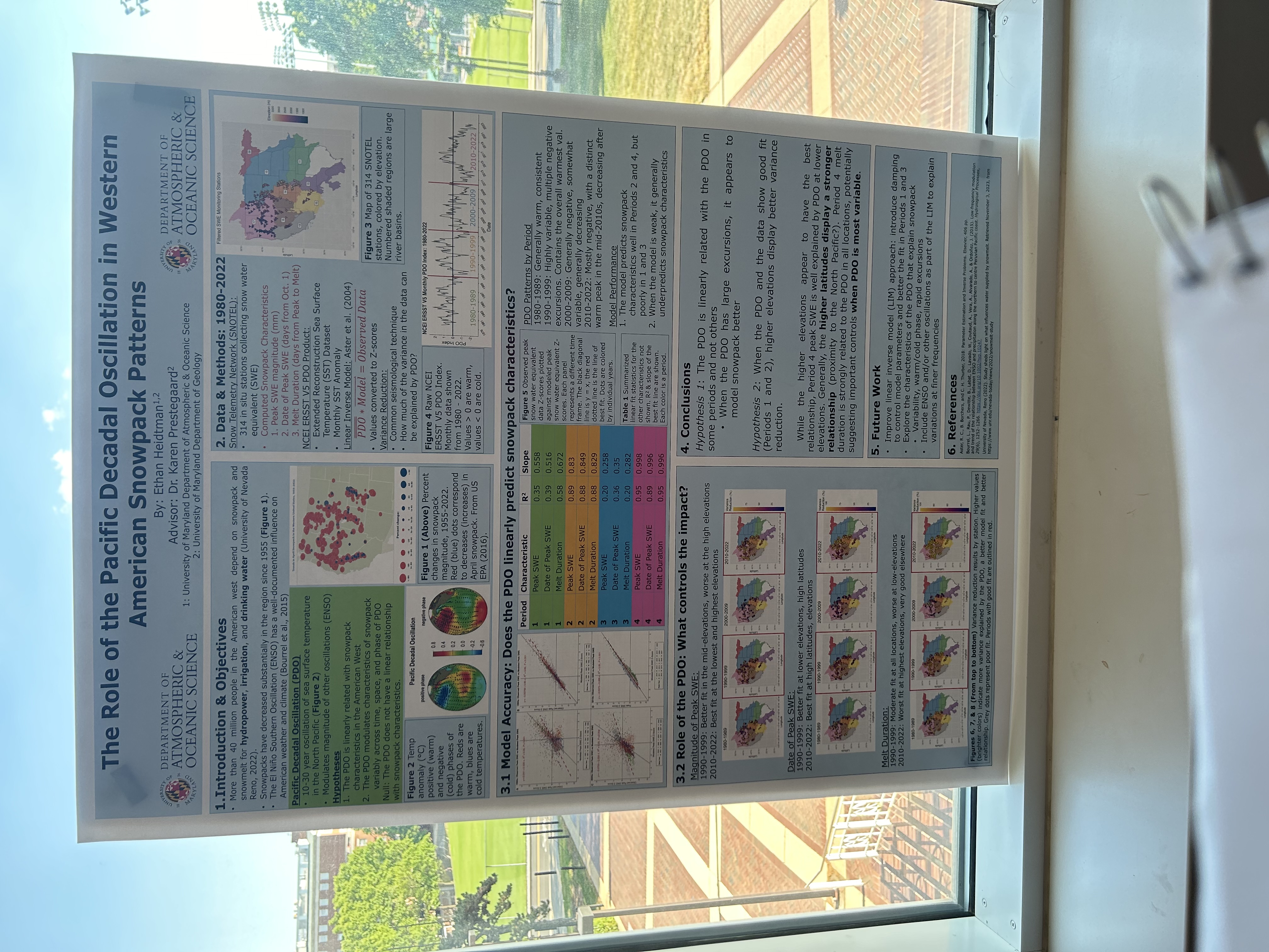
--- The goal of Ethan's project is to see if PDO is linearly related to Western snowpack. If this is true, PDO could be added as a parameter for predicting Western snowpack, potentially improving prediction accuracy.
--- Ethan looked at PDO from 1980 to 2022, and divided this period of time into four sections. The 1990s and 2010s were the most linear (particularly at higher elevations and latiudes).
--- Ethan assumed that ENSO had no influence on the data. He also noted that Climate Change was factored into the models used to gather data.
--- Ethan came to the conclusion that PDO is linearly related with Western snowpack when it has large excursions. He also noted that melt duration is strongly related to the PDO in all locations.
-
The poster and presentation was very interesting and effective. There was a good balance between graphics and text, making the poster readable and attractive to the eye. The presenter did a great job as well. He did a great job explaining the project, using very little jargon. He seemed very enthusiastic about his work, which kept me interested while he was speaking.
-
--- Poster Three: Investigation of the Dynamic Nature of Snow-Liquid Ratio (SLR) During the Course of a Winter Storm---
By Matthew Collins
-
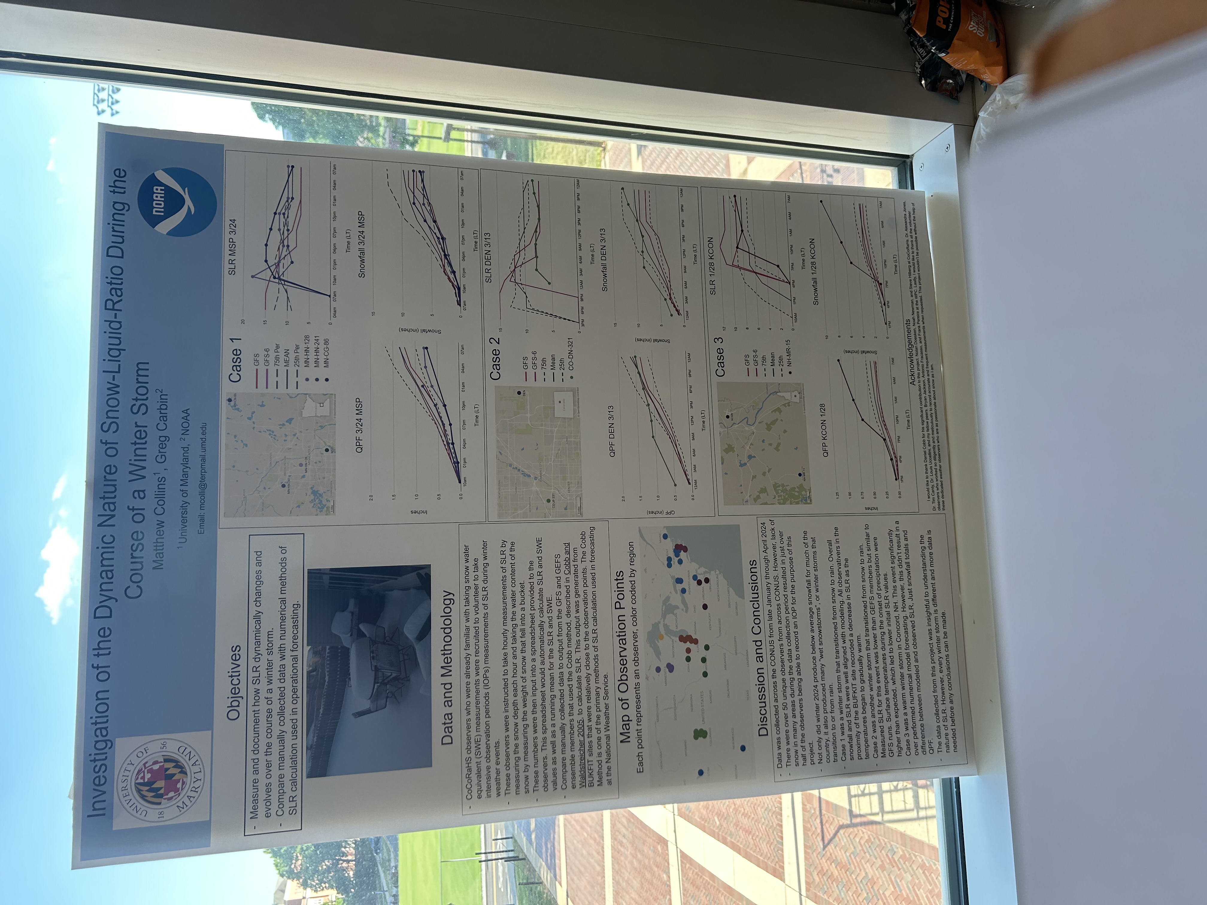
--- Matthew's goal was to evaluate how SLR dynamically changes and evolves over the course of a winter storm.
--- Compared manually collected data with numerical methods of SLR calculation used in operational forecasting. The manually collected data is provided by CoCoRaHS volunteer observers, with previous experience in SLR calculations, from across the continuous United States.
--- A below-average year for snow storms resulted in difficulty in obtaining many data sets.
--- Matthew noticed that as the temperature warms in a storm, the SLR decreases. In another scenario, he observed lower SLR values than predicted due to higher temperatures than expected.
--- The purpose of the project was not made clear, but I guess that this was done to show where models fall short.
-
The poster and presenter did a decent job. The poster had a good balance between graphics and text. The poster also described the project and methods of data collection very well. The presenter did a good job explaining everything, but did not seem very enthusiastic and was very monotone. The presenter and poster also failed to identify future plans and purpose. However, the presenter's performance did not take too much away from the overall quality of the project.
-
--- Poster Four: Winter Storm Severity Index (WSSI) for 2023-2024 using mPING ---
By Christian Boteler
-
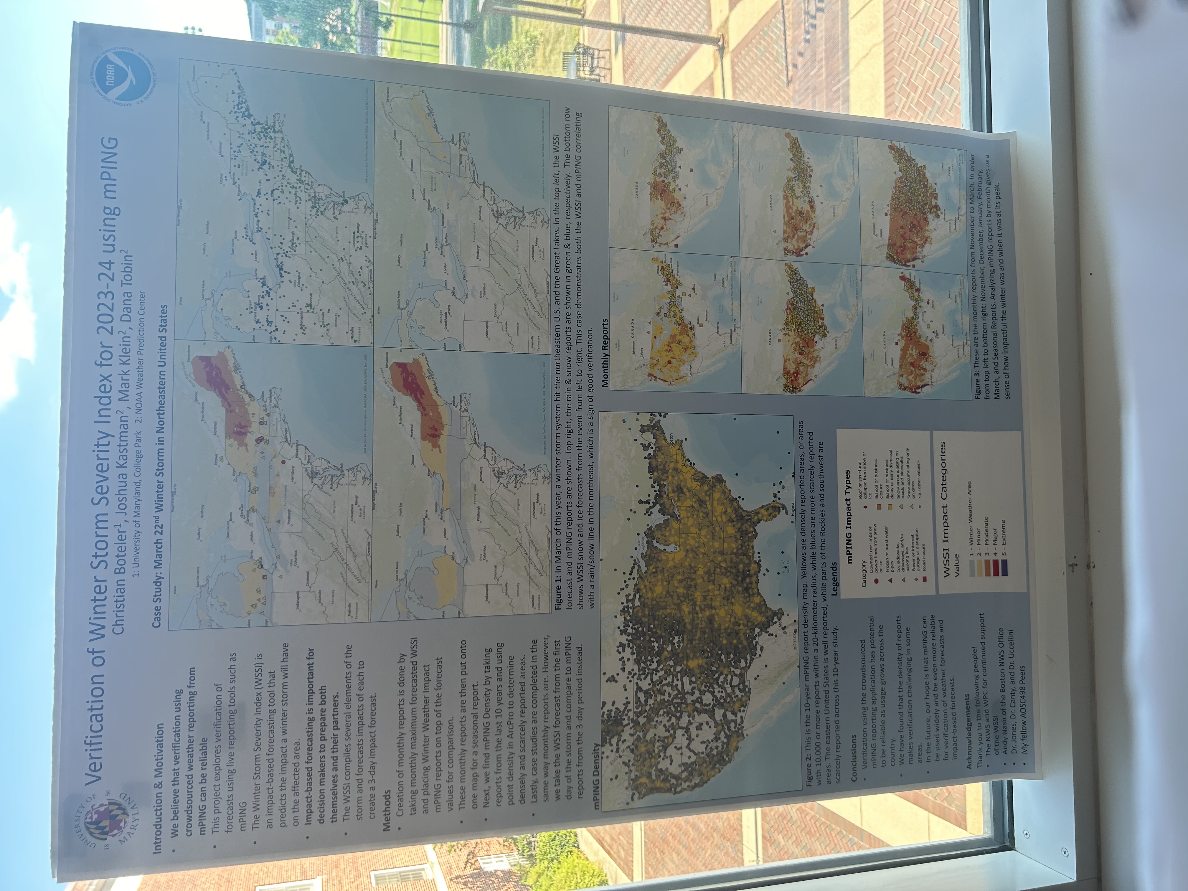
--- Project question: Is using crowdsourced weather reporting, from mPING, to verify the predicted WSSI reliable?
--- Christian took the monthly maximum forecasted WSSI event and placed winter weather impact mPING reports on top of the forecasted values for comparison.
--- Data shows that mPING reports have the potential to be a reliable way to verify forecasted WSSI as the usage of mPING grows across the country.
--- Christian acknowledges that the density of reports makes verification challenging in some areas, especially out west.
--- In the future, Christian hopes that mPING can be used widely and be even more reliable for verification of weather forecasts and impact-based forecasts.
-
The poster and presenter did an amazing job! The poster had a great balance of graphics and text. The maps in particular really helped me understand the outcome and processes of this project. The presenter did a great job maintaining my attention. He explained everything in a way that is easy to understand and made his motivation very clear.
-
--- Poster Five: Analyzing the Performance of NWS Stage IV Quantitative Precipitation Estimates (QPE) ---
By Domenic Brooks
-
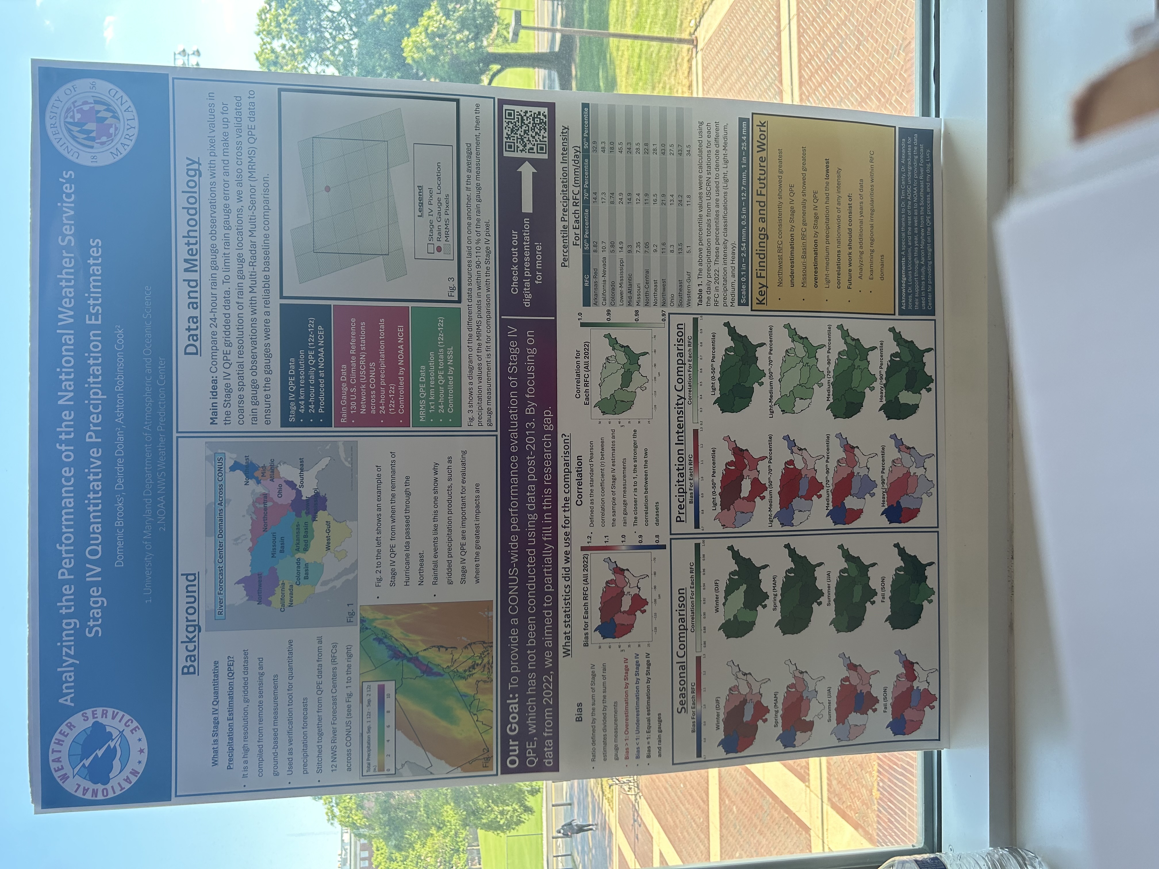
--- The goal of this project was to provide a nationwide performance evaluation of Stage IV QPE, which has not been conducted using data from post-2013. This was done to partially fill the research gap, only focusing on data from 2022.
--- Domenic compared twenty-four hour rain gauge observations with pixel values in the Stage IV QPE gridded data.
--- Domenic found that the Northwest River Forecast Office (RFC) showed the greatest underestimation and the Missouri-Basin RFC showed the greatest overestimation. Additionally, Domenic found that Light-Medium precipitation had the lowest correlations of any intensity.
--- Future work will include analyzing additional years of data and examination of regional irregularities within RFC Domains.
-
The poster and presenter did an excellent job. The poster had a great balance between text and graphics. The text was large enough to be easily read and the graphics are properly described and labeled. The presenter did a great job maintaining my attention, speaking in a very enthusiastic manner. He explained everything in great detail and in a way that I can understand.


